TropiSCO offers fine-grained monitoring of tropical deforestation in near-real time, using satellite radar imager. The interactive maps of deforestation demonstrate the urgency of protecting these ecosystems. It helps combat illegal logging and mining, illegal agricultural crops, and wildlife trafficking.

Forests provide humanity with many ecosystem services, such as climate change mitigation (carbon sinks) or soil erosion control. In particular, tropical forests, which account for half of the world's forests, possess rich biodiversity reserves, notably of molecules for the pharmaceutical industry, pollination, cultural and social services. However, forests are disappearing at an alarming rate. In addition to the loss of ecosystem services associated with the forest, deforestation has other negative effects: for example, the contact of wild animals and habitats with domestic animals and human populations leads to the emergence of infectious diseases. The tropical forest must therefore be protected and monitored.

forest lost


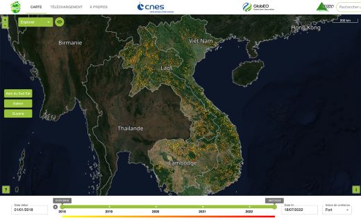
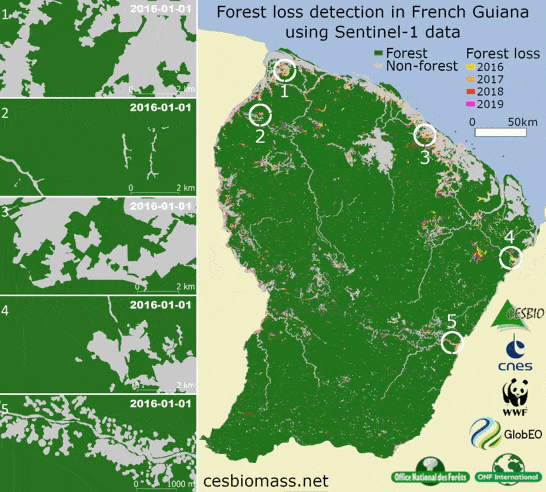
The TropiSCO project, labelled SCO in 2021, aims to map deforested areas using Sentinel-1 radar data every 6 to 12 days, regardless of weather conditions, and to publish the information so that local actors can intervene, alert public opinion, and account for lost surfaces. The data dissemination platform is developed to visualise the evolution of deforestation since 2018 in seven experimental areas deployed on three continents : Guyana-Suriname-French Guiana in South America, Gabon in Africa and Vietnam-Laos-Cambodia in Southeast Asia. All the world’s dense tropical forests will be eventually monitored in the frame of the TropiSCO project.

Compiling thousands of images on a weekly basis, the platform brings up monthly and annual statistics available for each territory. Governments, NGOs, fire monitors, universities, the general public and companies wishing to reduce the risk of deforestation in their supply chains can benefit from the easily usable and free data and statistics made available in the platform. These can be downloaded directly in Geotiff format or browsed via the WMS protocol.

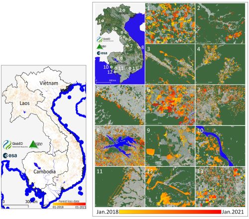
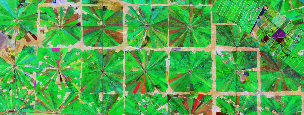
The maps provide clear hints of the spatial and temporal distribution of forest losses, prevalent and occurring everywhere. The results highlight the fact that the method provides not only quick alerts, but also reliable detections that can be used to calculate weekly, monthly, or annual forest loss statistics at the national scale. Specific areas of the whole forest loss map show to what extent forests are cut mostly for commodities, infrastructure construction, logging, tree, sugarcane, coffee, cashew, timber and rubber plantations …

tropisco southeast asia


TropiSCO is conducted in synergy with several SCO and other projects. Thanks to the collaboration of CNES, the CESBIO laboratory and the startup GlobEO, an innovative forest loss detection approach has been developed for years and tested on many territories. TropiSCO also benefits from a close collaboration with some partner countries in the Amazon, Congo and Southeast Asia basins to adapt the detection tool to their needs.

In less than two years, the TropiSCO project will be able to implement a unique operational observation tool, potentially covering all tropical forests at high spatial and temporal resolution. As a crucial tool for the future, TropiSCO will undoubtedly contribute to verifying the commitment of the signatory countries to the agreement to halt deforestation.

forest lost asia